
Tseries is a dedicated tool to present timeseries of meteorological data such as temperature, pressure, cloudiness, precipitation or wind for a certain location. This tool can also display data from ocean- and wave models, like wave height, sea level, wave period, current speed and direction.
Timeseries are highly intuitive plots and easy to understand, and are used both by forecasters and by the general public. Tseries can be integrated with the Diana presentation tool for location selection and for displaying data in a wider meteorological context.
Tseries is available as open source code from MET Norway’s web pages.
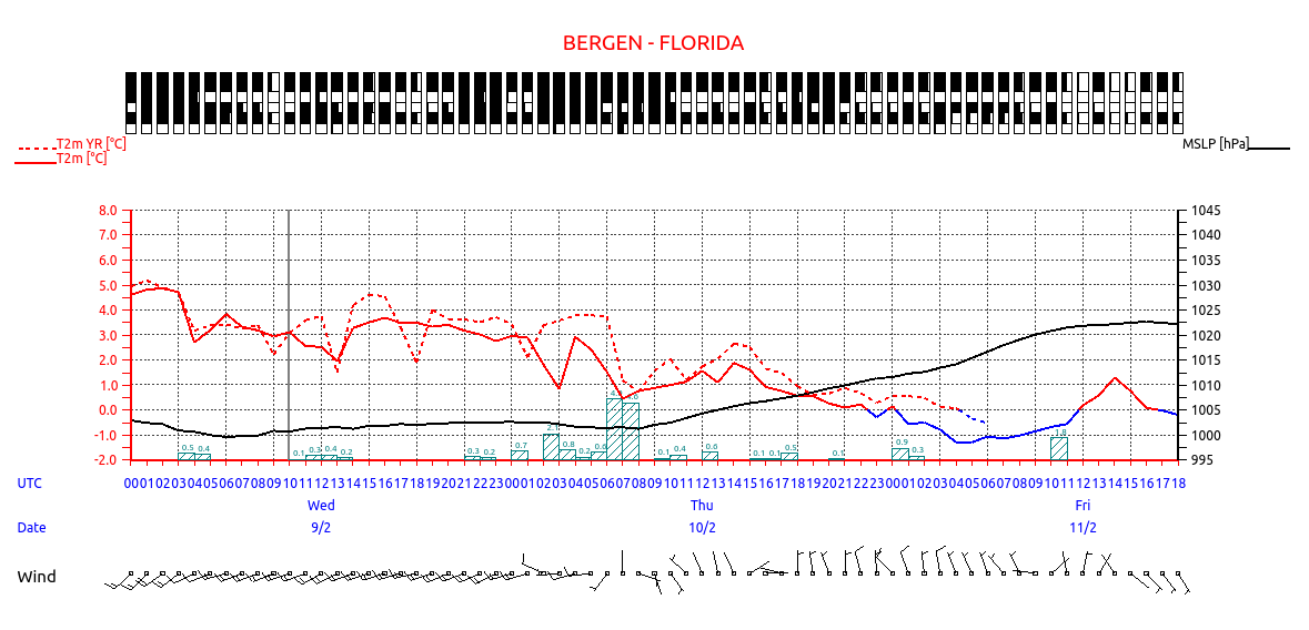
Tseries plot showing temperatures, pressure, precipitation, cloudiness and wind.